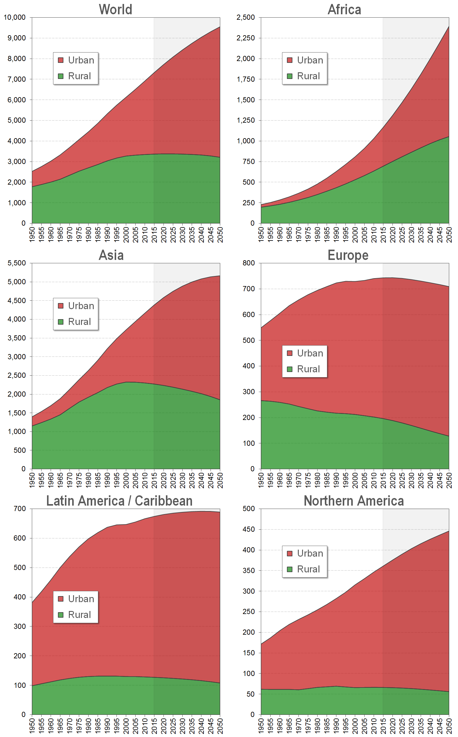
However the urban population is now growing rapidly. There are already more people living in urban then in rural areas and by the middle of the 21st century two-thirds of the world population may reside in urban areas - about 6.4 billion people.
Africa's population is still predominantly rural. However the urban population is rising rapidly. Within one generation (35 years) Africas urban population may be almost 1.4 billion people - as compared to a rural population of "only" 1 billion.
In Asia we can still find large rural populations. Currently, there are some 2.3 billion people residing in the rural areas of Asia.However, the rural population has been declining since 2000 and it will further decline over the next decades. By 2050, Asia will have only 1.85 billion rural residents. Asia's urban population, on the other hand, has been rising rapidly and will reach some 3.3 billion by 2050.
Europe's rural population has been declinging since the early 1950s, while the urban population has been growing. Today, Europe (including the Russian Federation) has some 202 million rural and about 538 urban residents. By 2050, Europes rural population will decline to 188 million; the urban population will slightly increase to 555 million.
Latin America and the Caribbean have been highly urbanized since the 1950s. Today, the region has about 547 million urban residents, but only 129 million people living in rural areas. Over the next 35 years the rural population in Latin America and the Caribbean will decline to 108 million, while the urban population will increase to 581 million.
Finally, Northern America: Here the rural population has been almost constant over the last 65 years. In 1950, 62 million resided in rural areas; today there are 66 million rural residents. However, the number of rural residents will decline in the future. In 2050 Northern America is projected to have a rural population of only 56 million.
The urban populatio, however, has continuously increased since the 1950 and will grow: In 1950, Northern America had an urban population of about 110 million; today there are 295 million, and by 2050 there will be 390 million people living in urban areas of Northern America.
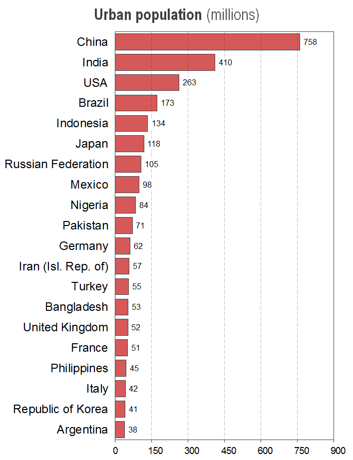
India's urban population numbers 410 million. The third largest urban population is already that of the United States of America - wirth around 260 million.
Brazil has the third largest urban population with 173 million urban residents.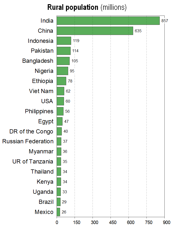
All other rural populations in the world are significantly smaller. Indonesia, which is the country with the third "largest" rural population, has only 119 million rural residents.
These numbers clearly show that currently most rural residents in the world are living in India and China.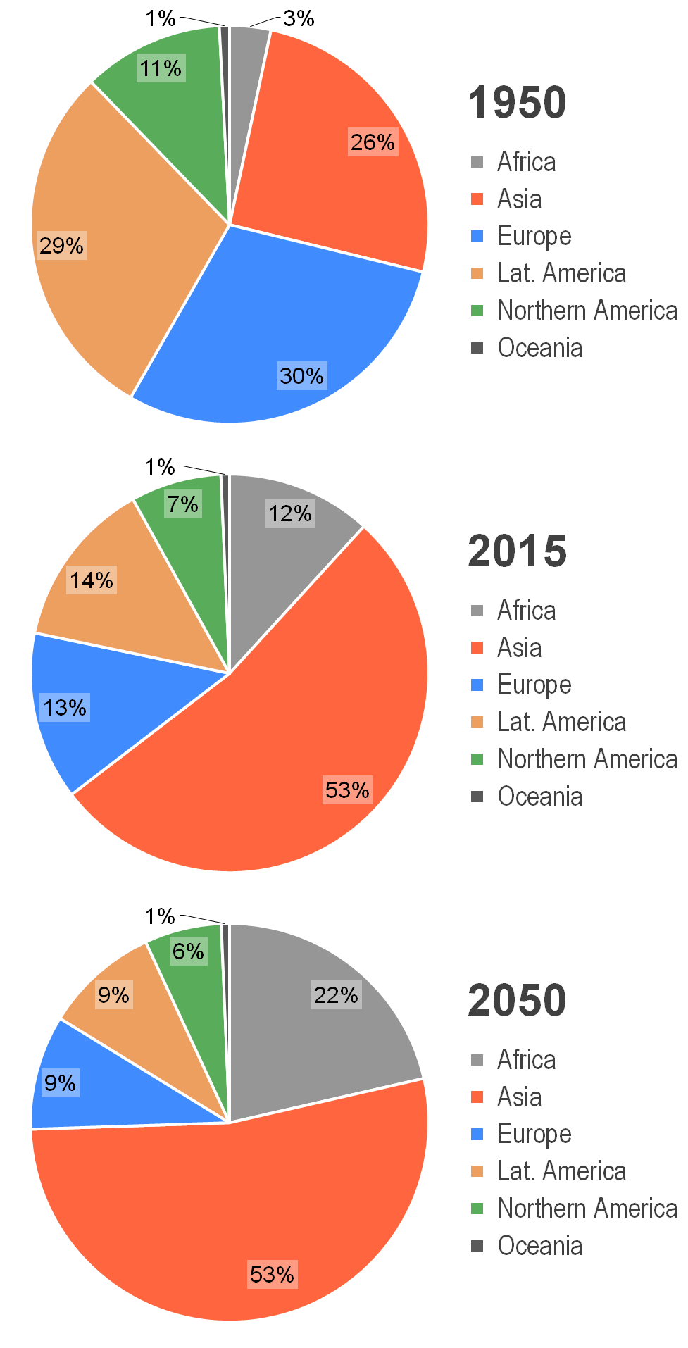
Today, the geographical distribution of urban population around the world is entirely different: 53% of all urban residents are Asian, and already 12% are African. Latin America's and Europe's share of the urban world population has significantly declined to 14% and 13%, respectively; Northern America is now only home to 7% of the urban world population.
By 2050, that is in just one generation, three-quarters of the urban world population will reside in Africa and Asia. This is a complete reversal of the situation just 100 years ago. Some 22% of the urban world population will reside in Africa, 54% in Asia. Europe, Latin America and the Caribbean, and Northern America will account for just 9%, 9% and 6% of the urban population of the world.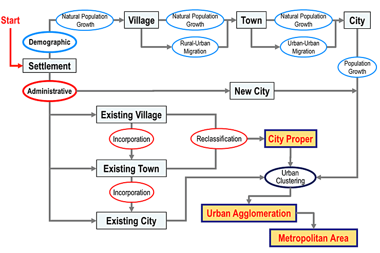
Estimating the population of urban agglomerations over historical time periods is a major challenge due to the complexity of the urban growth process. Villages can become towns, towns can grow into cities, and cities can be transformed into urban agglomerations in a number of ways:
They may increase due to natural population growth - as a result of a larger number of births than deaths; they may grow due to rural-urban or urban-urban migration; or they may emerge as a result of administrative changes.
These administrative changes can also involve several different processes: They may include the incorporation of sub-urban areas or neighboring towns into a larger city or the foundation of a completely new city - as was the case with several newly established national capitals. Administrative changes also include the re-naming of urban agglomerations - particularly those that had foreign names been assigned during the colonial period.
The diagram above tries to highlight some of these processes. The challenge of estimating the population of human settlements arises from the fact that both their name and their physical extend may have changed over past decades - sometimes several times. Different towns (with different names) may have been combined into one urban agglomeration - with the name of one of the original towns or with a completely new name. Population statistics referring to a "city proper" may be discontinued and replaced by data for the much larger area of an "urban agglomeration" with the same name - which may, or may not, include other neighboring cities.
The United Nations World Urbanization Prospects makes an effort to prepare consistent population estimates over historical time periods for human settlement that follow the same definition. This often requires that historical population estimates have to be re-adjusted to a current definition that may not necessarily coincide with other popular definitions for that city.
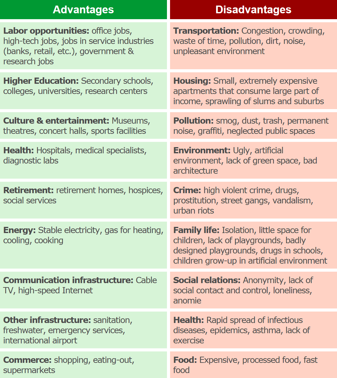
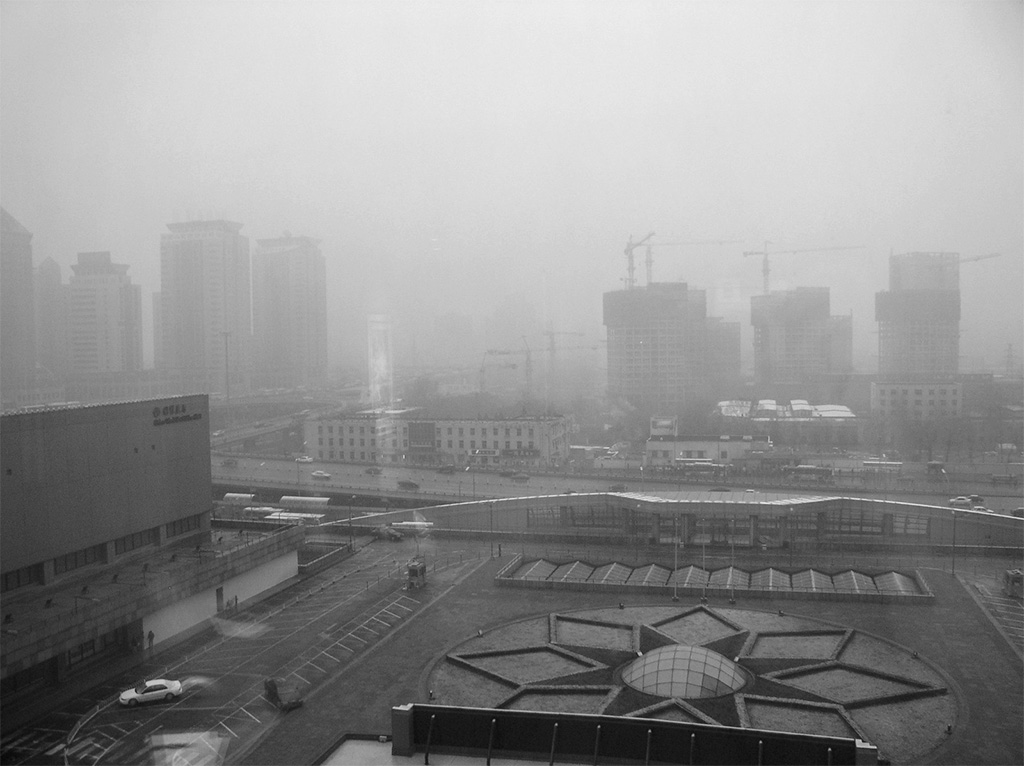
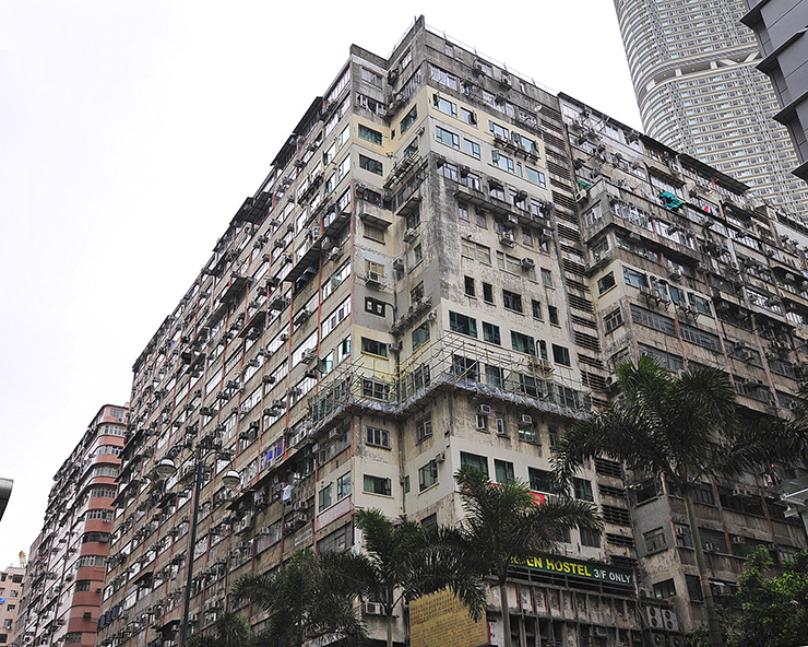
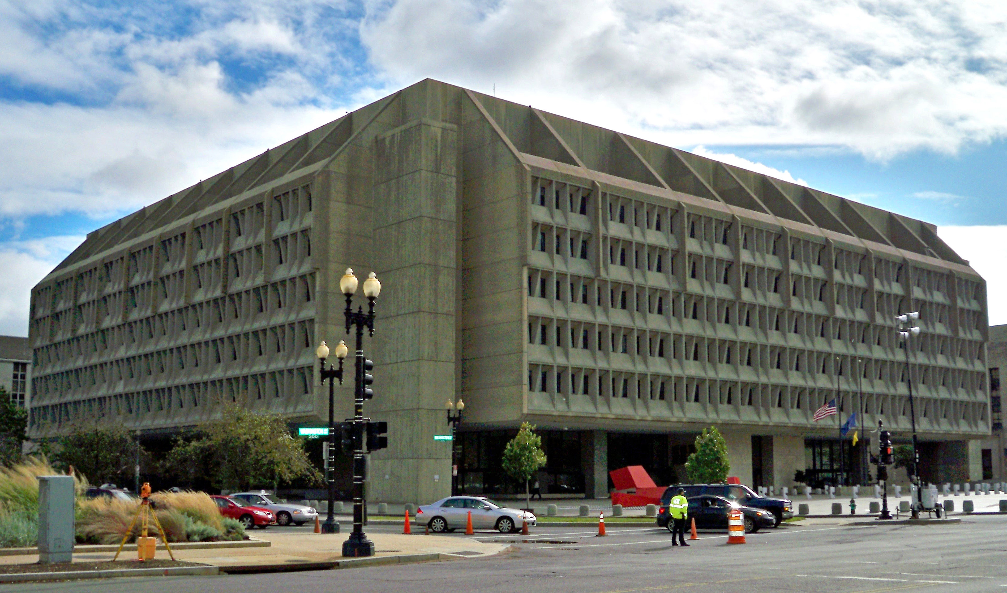
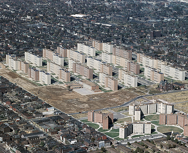
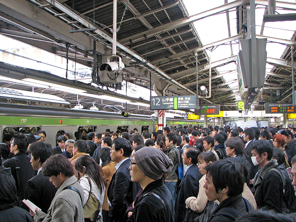
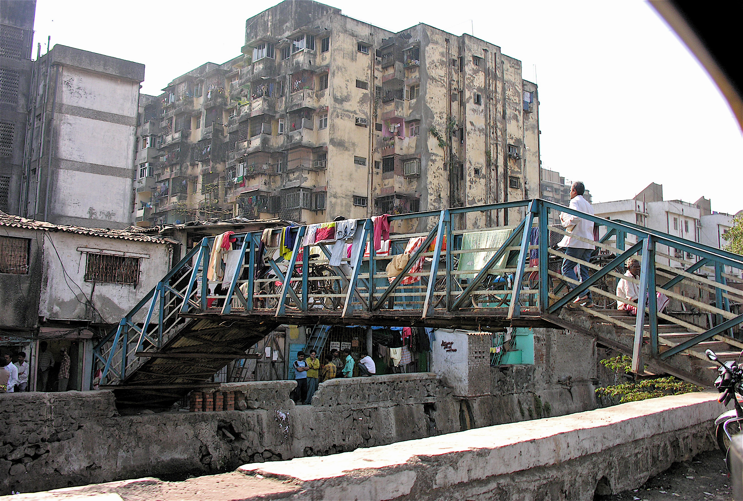
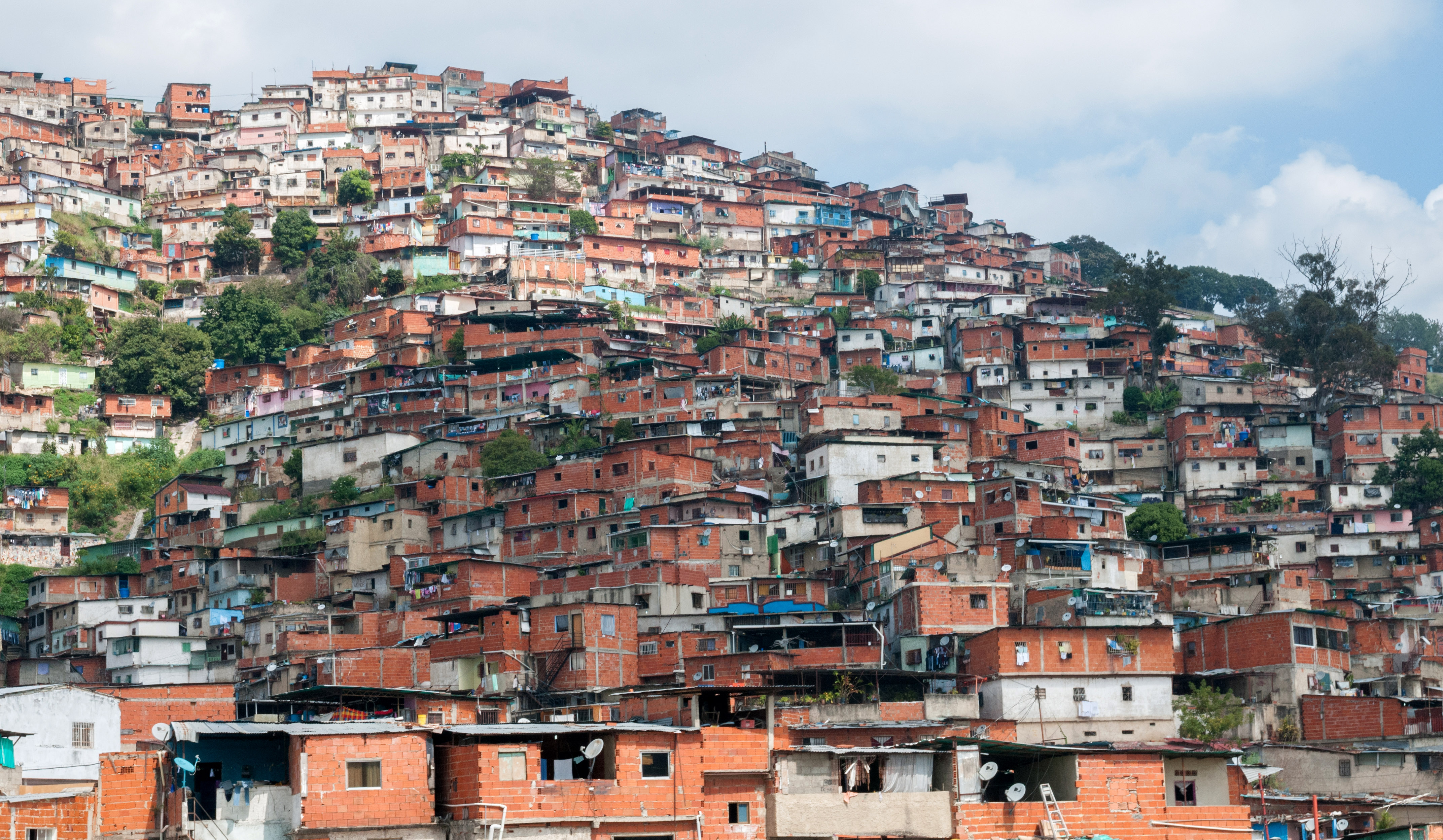
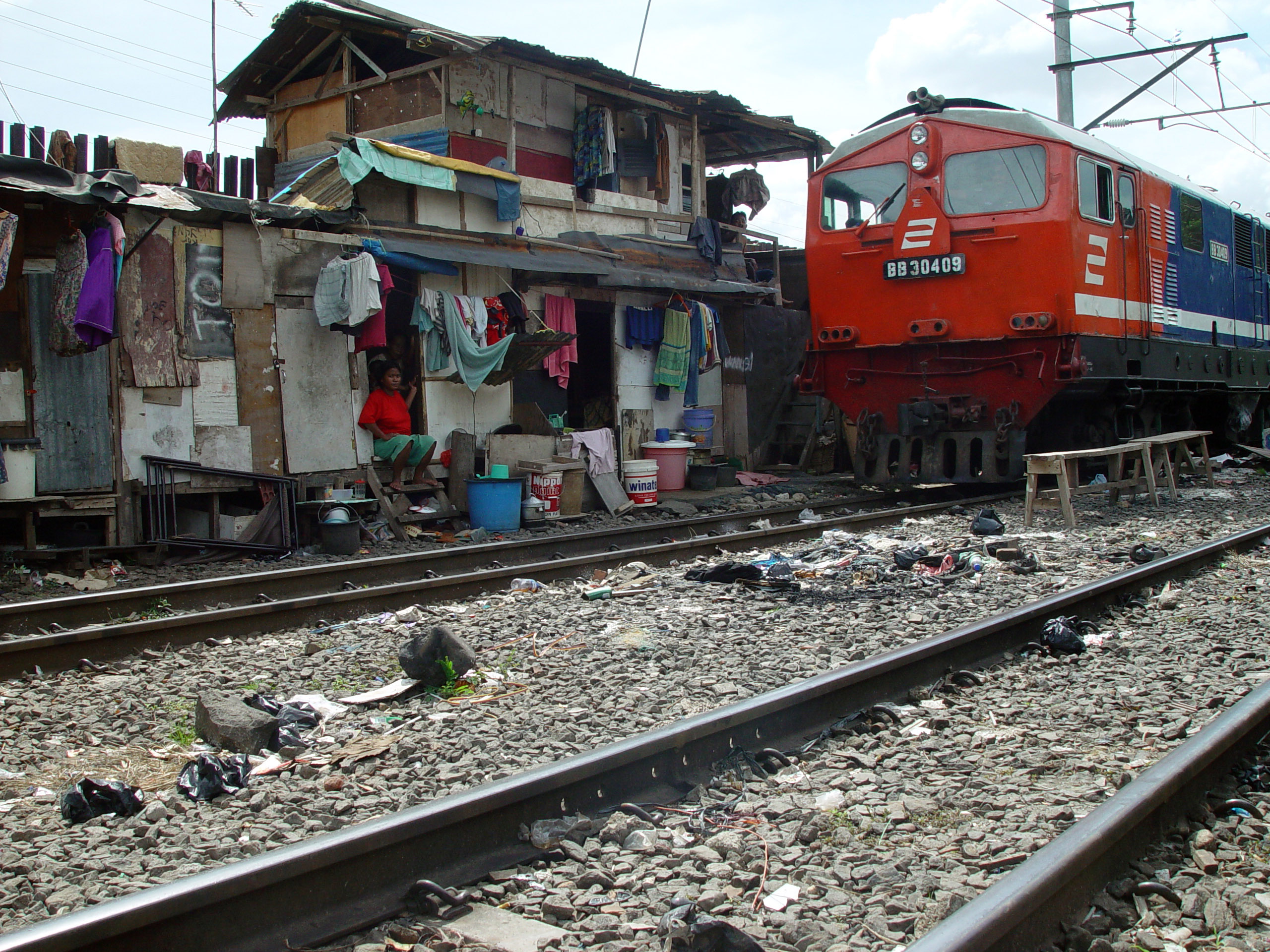
With the rapid urbanization of the world it seems obvious that urban life must have many advantages. But I would argue that people are not necessarily preferring city life, but often have no alternative.
The "green revolution" and the mechanization have greatly increased agricultural productivity - with the consequence that millions of farmers and farm workers are no longer needed in the rural areas.
Also, we should not forget that urban growth is now often driven primarily by population growth within cities. Many urban dwellers where born in a city and have never experienced life in a rural area. The urban population of the world is increasingly perceiving their environment without alternative.
Only in the most advanced urbanized countries we can observe new trends of "urban agriculture" or "green living". Small groups of the urban population in wealthy countries try to recreate the "lost rural world" to improve their quality of life.
It also appears that "urban agriculture and forestry" may be important for improving food security and quality of life in the urban agglomerations of developing countries.
Cofie, O., Drechsel, P., Veenhuizen, R. (2003) : Contribution of Urban and Periurban Agriculture to Food Security in Sub-Saharan Africa, RUAF Foundation: http://www.ruaf.org/node/1130
Kedmey, Dan. 2016. Skyscrapers - but no sewage system. Meet a city run by private industry. IDEAS.TED.COM, March 17
Kitilla, D. & Mlambo, A. (2001): Integration of Agricolture in City Development in Dar Es Salama. In: UA Magazine No. 4, P. 22-24. RUAF Foundation, 2001.
Kusisto, Laura. 2016. More Americans Are Again Moving to Suburbs Than Cities. The Wall Street Journal, March 24
Laing, Olivia. 2016. The Lonely City. Adventures in the Art of Being Alone. Picador. ISBN-10: 1250039576
Potutan, J. et al. (2000): Urban Agriculture in Cagayan de Oro: A favourable response of City Government and NGOs. In: Growing Cities, Growing Food - Urban Agriculture on the Policy Agenda, p. 413-428. Deutsche Stiftung für internationale Entwicklung (DSE). Feldafing, Germany.
Randrup T.B., Schipperijn J. and Konijnendijk C.C. (2007) Urban and Peri-urban Forestry and Greening for West and Central Asia FAO, Rome.
Schiere et al. (2006): Livestock keeping in urbanised areas, does history repeat itself? In: Cities Farming for the Future - Urban Agriculture for Green and Productive Cities P. 349 – 366: http://www.ruaf.org/node/976
Tixier, P. & De Bon, H. (2006) : Urban Horticulture. In : Cities Farming for the Future, P. 316 – 335. http://www.ruaf.org/node/989
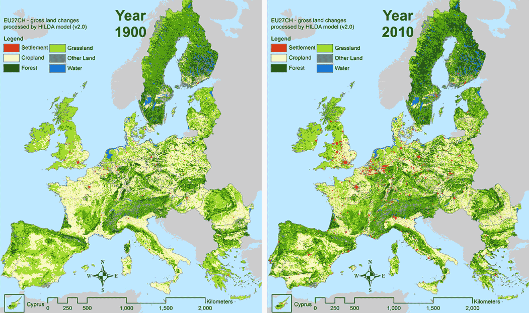
Urbanization does not necessarily mean loss of natural land cover - just the opposite. With urbanization it is often possible - or even unavoidable - that rural areas are de-populated. When young people move from rural to urban areas, small-scale agriculture declines, as the remaining older population is unable or unwilling to cultuvate the land. Only large-scale agribusinesses will cultivate the best arable land.
Eventually, the uncultivated land is covered by natural reforestation. In some cases, nature parks and preservation areas are established or expanded.
The maps above show results from an analysis of historic and current land cover in Europe. One can easily see that Europe today is much "greener" than it was in 1900 - despite (or because of) urbanization.
R. Fuchs, P.H. Verburg, J.G.P.W. Clevers, M. Herold, (2015): The potential of old maps and encyclopaedias for reconstructing historic continental land cover/use change, Applied Geography, 59, 43-55. doi:10.1016/j.apgeog.2015.02.013
R. Fuchs, M. Herold, P.H. Verburg, J.G.P.W. Clevers (2013): A high-resolution and harmonized model approach for reconstructing and analysing historic land changes in Europe, Biogeosciences, 10(3), 1543–1559, doi:10.5194/bg-10-1543-2013 [online] Available from: http://www.biogeosciences.net/10/1543/2013/, 2013.